


New results in the analysis of the settlement structure of the Bronze Age tell at Füzesabony
The first excavations of the Bronze Age tell in Füzesabony began nearly 90 years ago. The leader of the excavations, Ferenc Tompa was digging in short periods between 1931 and 1937. During his research – beside a large amount of ceramic finds – numerous settlement features were found, which made the understanding of the internal structure of the settlement possible. A more detailed study and a re-evaluation of the tell and its material began only a great deal later in the 1980s. This was only made possible due to the rescue excavations of 1976 led by Ilona Stanczik.
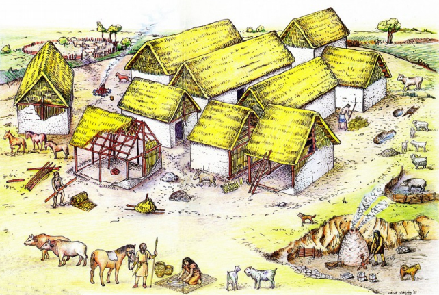
Reconstructed Bronze Age scene based on the excavation of the tell settlement of Füzesabony (Szathmári 1991, Fig. 47)
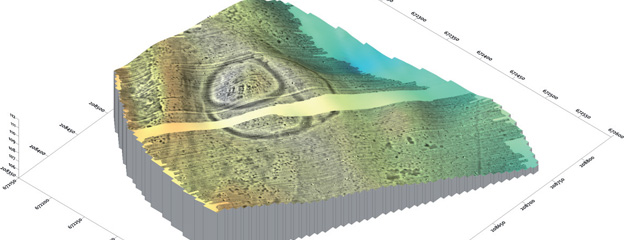
The fine excavation- and documentation methods that were used helped us to understand the old documentations and to interpret the old finds. The results of that investigations regarding the inner and outer settlements of the tell could be modified by using modern methods, like magnetic survey, GIS based analysis and aerial photographs.
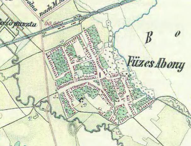
Füzesabony–Öregdomb depicted on a map from the 2nd military survey (1806-1869)
Füzesabony is located in the south-eastern part of Heves county, South of the border between the Northern Mountain Range and the Great Plain. The plain area is bordered by the Laskó stream to the West and by the Eger stream to the East. The originally oval shaped Öregdomb (Old Hill, formerly known as Nagyhalom = Great Mound) lies at the South-western edge of the village Füzesabony, where the Laskó with its strong bends bypasses the site at north-northeast. What we see today is a result of serious water management works of the early 1930’s, when the stream was channelled through a ditch crossing and cutting the tell’s core.
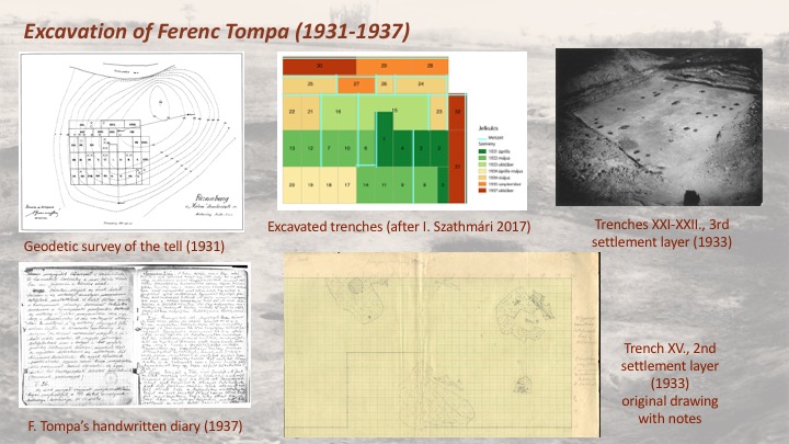
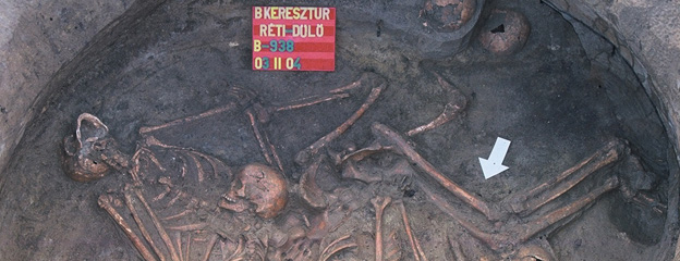
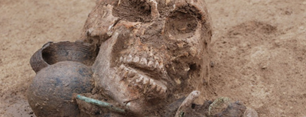
The excavations of Tompa between 1931-37 were carried out in the central part and at the south-western edge of the tell. This was clearly observed, since the stratigraphy of the trenches were getting smaller and less features were documented. In the central parts of the tell Tompa reached the paleosol at 240-260 centimetres, but he didn’t excavate to that level in all of the trenches. We know from Tompa’s handwritten excavation diary and notes, that he was digging in spits. Today it is widely known that this method can not be used to excavate multilayer settlements: spits ignore settlement layers and features, which makes it difficult, or even impossible to establish the exact chronology of finds. I myself faced this problem during the conventional processing of the finds. Probably as a result of the old excavation methods Tompa could only observe three settlement layers. At the northern edge of the settlement Tompa even found some Early Iron Age skeleton burials which let him date the settlement incorrectly to the Late Bronze Age.
In 1976 modern excavation methods were used to identify settlement layers and features in order to re-evaluate the old excavation finds and the chronology of the tell. However, it can not be ignored that by that time two-third of the settlement was excavated or destroyed, and only an area of 100 square meters could be explored. The new excavations clearly identified 5 settlement layers with a thickness of 240-250 cm. The tell was founded and inhabited by the people of the Füzesabony culture. They used the village for a relatively long period renewing the houses on the same spot. The fall of the settlement can be dated to the Koszider period.
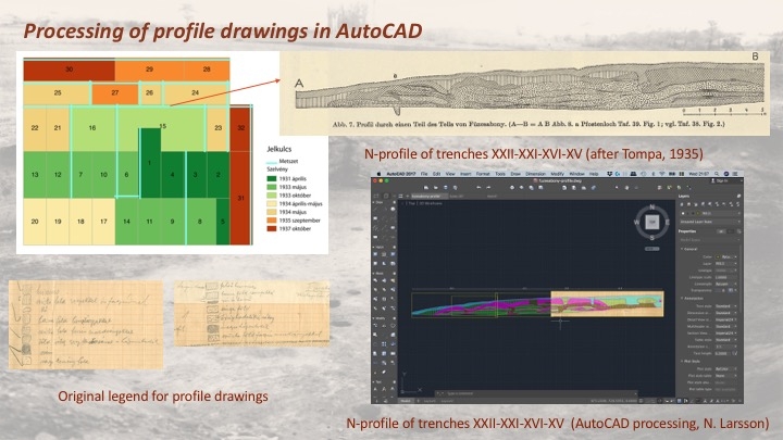
In their lecutre at the conference held in Miskolc on 8th June 2018, Ildikó Szathmári and Szilvia Guba presented new research results that aimed at the geoinformatic processing of the excavation documents from Ferenc Tompa’s excavation and the subsequent authentication campaigns. During the work, they focused mainly on defining the external settlement and clarifying the previously assumed fortifications of the tell. Geospatial processing also enabled the precise localization of the original survey trenches.
References
Szathmári I. 1991: Füzesabony–Öregdomb. In: Raczky Pál (szerk.): Dombokká vált évszázadok – Bronzkori tell-kultúrák a Kárpát-medencében. Budapest – Szolnok, 1991, 40-43.
Szathmári, I. 1992: Füzesabony-Öregdomb. In: Meier-Arendt, W. (Hrsg.): Bronzezeit in Ungarn. Forschungen in Tell-Siedlungen an Donau und Theiss. Frankfurt am Main 1992, 134–140.
Szathmári, I. 1997: Das Gräberfeld der bronzezeitlichen Füzesabony-Kultur in Füzesabony-Kettőshalom. Communicationes Archaeologicae Hungariae 1997, 51–74.
Szathmári, I. 2003: The Florescence of the Middle Bronze Age in the Tisza Region: the Füzesabony culture. In: Zs. Visy (ed.), Hungarian archaeology at the turn of the Millennium. (Budapest 2003) 156–157.
Szathmári, I. 2011: Megjegyzések a füzesabonyi bronzkori tell telep időrendjéhez. – Remarks on the chronology of the Bronze-Age tell settlement at Füzesabony. In: Tóth, E.–Vida, I. (szerk.): Corolla museologica Tibor Kovács dedicata. Libelli Archaeologici Ser. Nov. IV/Régészeti Füzetek Új Sorozat IV, Budapest 2011, 485–503.
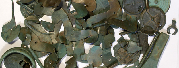
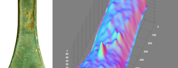
Szathmári, I. 2017a: On the metallurgy of the Füzesabony culture. Bronze finds and casting moulds from the Füzesabony Bronze Age Tell settlement. Communicationes Archaeologicae Hungariae 2017, 51-84.
Szathmári, I. 2017b: On the Terminal Period of the Füzesabony-Öregdomb Bronze Age Tell Settlement. In: G. Kulcsár / G. V. Szabó / V. Kiss / G. Váczi (eds.), State of the Hungarian Bronze Age Research. Proceedings of the conference held between 17th and 18th of December 2014. Prehistoric Studies II. (Budapest 2017) 49–60.